




Build Skills WebGIS
From Foundation to Implementation

Build Skills WebGIS From Foundation to Implementation

Learn WebGIS intensively for 11 weeks through hands-on practice, modern development workflow, mentor guidance, and a final project for your portfolio.

Beginner Friendly
Expert Instructors
ESSENTIAL Discount up to 60%
gift Bonus Access 1 Video Learning
✅ Suitable for geoscience, environmental, and spatial backgrounds

Why Learn WebGIS?

check icon

A Rare and Valuable Skill Combination

Combines spatial analysis with the ability to build map-based web platforms—an uncommon skill set, especially outside the IT field.

check icon

Advance Your Existing Skills

If you are already familiar with location data or mapping, WebGIS helps you elevate those skills into real-world implementation, not starting from scratch.

check icon

More Valuable in the Workplace

Not only analyzing data, but also presenting it in a usable format for teams, making your skills more relevant across various professional contexts.

check icon

Opportunities for Projects and Career Growth

Develop more practical location-based projects for work, research, or career exploration.

check icon

Increasing Demand Across Industries

From urban planning to environmental and business sectors, location-based dashboards and applications are increasingly in demand.
Program

Start Building Your First WebGIS in 11 Weeks

Learn to transform location data into interactive map dashboards through a practical, step-by-step approach.

card-1
card-2
card-3
card-4
card-5

This program is suitable for

student

Students

fresh_graduate

Fresh Graduates

professional

Professionals

career_shifter

Career Shifters

Class Information

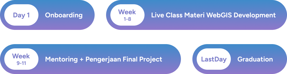
Bootcamp Program Stages

timeline

Upcoming Class

MAPID Academy WebGIS Development Bootcamp #3

MAPID Academy WebGIS Batch 3

Registration Period

April 30 – June 3, 2026

Bootcamp Period

June 5 – August 18, 2026


Class Schedule

Week 1–8 (Live Classes)

Conducted during Weeks 1–8
Every Monday & Friday (19:00 – 21:00 WIB)

Class Schedule

Week 9–11 (Mentoring & Final Project)

Mentoring and final projects take place during Weeks 9–12. The schedule is flexible based on agreement with your mentor.

Curriculum


Introduction to WebGIS

  • Onboarding Program
  • Introduction to WebGIS

Mentors

mentor 1

Dzikri Nashrul

Data Lead - MAPID

dipo_rizky

Rifqi Naufal

GIS Developer - Agriculture Company

rifqi_naufal

Ahmad Z. Faiz

Senior Software Engineer - Agriculture Tech Company (Remote)

Vino Arystio

Raden Pranantya

GIS Expert - Tech Startup (Remote)

Trusted by Hundreds of Alumni from Various Institutions

Hundreds of participants from universities, government agencies, and data-driven companies have attended the MAPID ACADEMY to master WebGIS Development

peserta 0 peserta 1 peserta 2 peserta 3 peserta 4 peserta 5 peserta 6 peserta 7 peserta 8 peserta 9 peserta 10 peserta 11 peserta 12 peserta 13 peserta 14 peserta 15 peserta 0 peserta 1 peserta 2 peserta 3 peserta 4 peserta 5 peserta 6 peserta 7 peserta 8 peserta 9 peserta 10 peserta 11 peserta 12 peserta 13 peserta 14 peserta 15 peserta 0 peserta 1 peserta 2 peserta 3 peserta 4 peserta 5 peserta 6 peserta 7 peserta 8 peserta 9 peserta 10 peserta 11 peserta 12 peserta 13 peserta 14 peserta 15 peserta 0 peserta 1 peserta 2 peserta 3 peserta 4 peserta 5 peserta 6 peserta 7 peserta 8 peserta 9 peserta 10 peserta 11 peserta 12 peserta 13 peserta 14 peserta 15

Alumni Experiences

Person

Bootcamp Pricing

An Investment in Skills You Can Apply, Not Just Learn

Exclusive Benefits You Won’t Find Anywhere Else

icon-javascript

Live Interactive Class + Lifetime Recording Access

Live sessions twice a week (weeks 1–8) with recordings accessible anytime.

icon-javascript

Access to MAPID Maps API Premium

Get access to basemaps and geospatial data for your projects.

icon-javascript

Location Analytics Platform (3 Months)

Use the GEO MAPID Location Analytics Platform to support exploration and development of your WebGIS projects. Trusted by thousands of users ranging from business owners to researchers.

icon-javascript

Experienced Mentors

Learn directly from experienced mentors who are experts in their fields.

icon-javascript

AI-Supported Workflow ✨

Learn to use a modern development workflow to help you explore UI, troubleshoot, and implement WebGIS more efficiently.

EARLY BIRD

Rp 3,000,000

71% Off

Rp 849,000

Quota Filled

  • Active Student or University Student
  • Fresh Graduate (within 6 months after graduation)
  • Currently Unemployed
  • Must have a verifiable Student ID Card

ESSENTIAL

Rp 3,000,000

60% Off

Rp 1,199,000

May 12 - May 26, 2026

gift

Bonus Access 1 Video Learning exclamation_mark

(Senilai Rp 109.000)
Lihat pilihan video exclamation_mark
poin

Harga akan naik menjadi
Rp 1.349.000 pada 27 Mei 2026

  • Active Student or University Student
  • Fresh Graduate (within 6 months after graduation)
  • Currently Unemployed
  • Must have a verifiable Student ID Card

Register Now

LAST CHANCE

Rp 3,000,000

55% Off

Rp 1,349,000

May 27 - June 3, 2026

  • Active Student or University Student
  • Fresh Graduate (within 6 months after graduation)
  • Currently Unemployed
  • Must have a verifiable Student ID Card

Registration Process

1.

Register

Click the "Register Now" button to sign up

2.

Complete the Registration Form

Before filling out the form, ensure that location access is enabled. Complete all required fields and submit. Make sure all information provided is accurate.

3.

Payment Information via WhatsApp

After submitting the form, check your registered email or WhatsApp for payment instructions.

4.

Group Invitation

After completing payment, within 2x24 hours, our team will invite you to the group.

Register Now

Alumni Portfolio

Frequently Asked Questions

MAPID WebGIS Ecosystem: From Competition to Real Projects

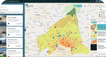
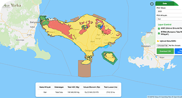
In 2025, MAPID आयोजित a WebGIS Competition participated in by hundreds of students from various universities across Indonesia. Through this program, numerous WebGIS projects were developed—demonstrating how location data can be transformed into interactive and practical map-based applications.

Explore the best projects and see how WebGIS is applied across real-world use cases.

Terms and Conditions
Introductions
  • MAPID is a platform that provides Geographic Information System (GIS) services for managing, visualizing, and analyzing geospatial data.
  • This platform is owned and operated by PT Multi Areal Planing Indonesia, located at